 |
|
ABU SIMBEL - EGYPT
 |
 |
| Location: | Geographic coordinates: | Area: | Area - comparative: |
| Northern Africa, bordering the Mediterranean Sea, between Libya and the Gaza Strip | 27 00 N, 30 00 E | total: 1,001,450 sq km | slightly more than three times the size of New Mexico |
| Population: | Languages: | Capital: | Currency: |
| 69,536,644 (July 2001 est.) | Arabic (official), English and French widely understood by educated classes | Cairo | Egyptian pound (EGP) |
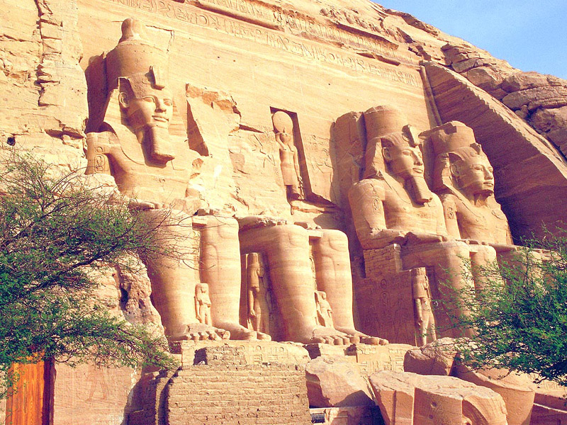
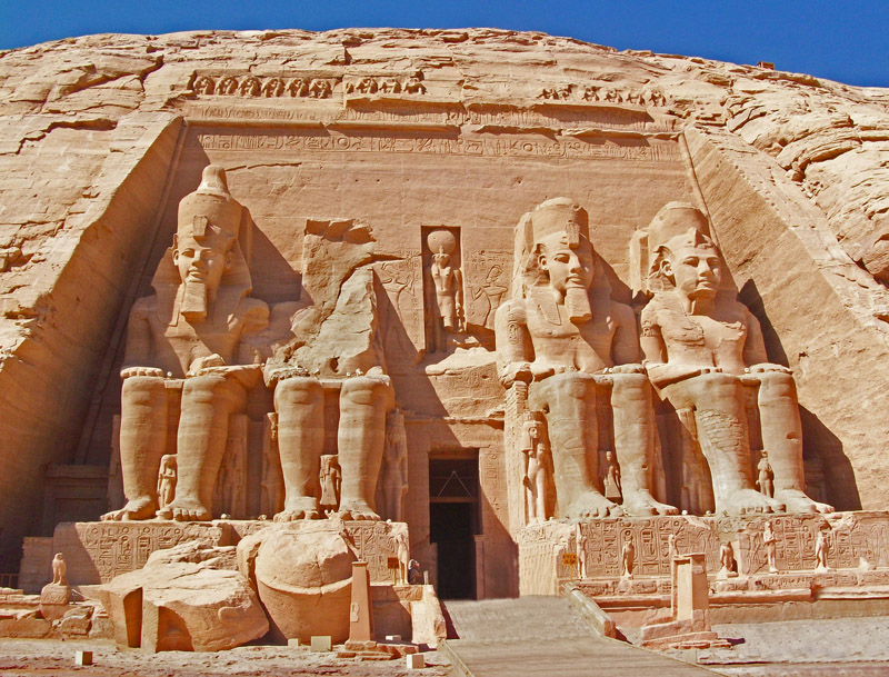
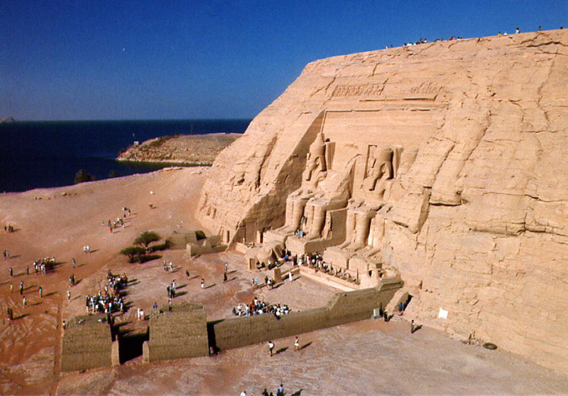
| Types of rocks used on the monument: | Abu SImbel was carved out of a Sandstone mountain. |
Abu Simbel is an archaeological site comprising two massive rock temples in southern Egypt on the western bank of Lake Nasser about 290 km southwest of Aswan. The twin temples were originally carved out of the mountainside during the reign of Pharaoh Ramesses II in the 13th century BC, as a lasting monument to himself and his queen Nefertari, to commemorate his alleged victory at the Battle of Kadesh, and to intimidate his Nubian neighbors. However, the complex was relocated in its entirety in the 1960s, on an artificial hill made from a domed structure, high above the Aswan High Dam reservoir. The relocation of the temples was necessary to avoid their being submerged during the creation of Lake Nasser, the massive artificial water reservoir formed after the building of the Aswan High Dam on the Nile River. Abu Simbel remains one of Egypt's top tourist attractions.
© Guillermo Rocha, P. G. / Brooklyn College Geology Department