How to use a compass
|
|
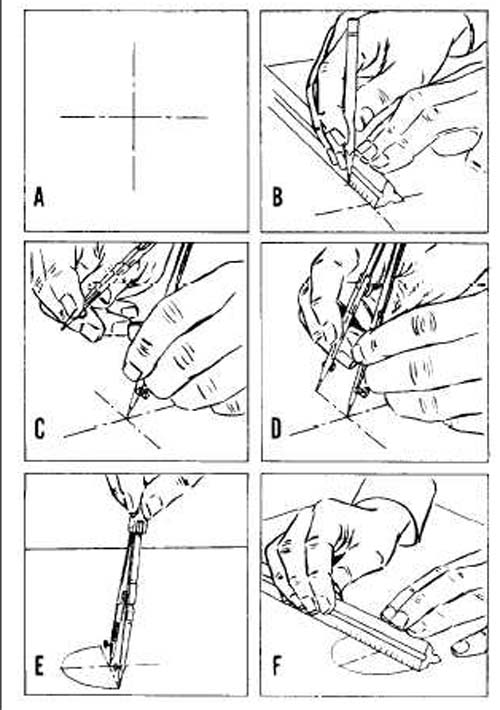
A. Mark the point that is going to serve as the center of your circle. For our exercise the center is going to be the city where the seismogram came from. B. Using your ruler, measure the distance in the map of how many kilometers or miles was the epicenter of the earthquake from that city. C. Handling both legs of the compass the point and the pencil part, measure the same distance that you have measured with the ruler. This distance is your radius. D. Place the point of the compass in the city, that is the center of your circle. E. Draw a circle around the city. The earthquake has happened somewhere within that cirlce. F. Double check by measuring the radius again to see if that matches the distance that you have obtained by calculating the SP - interval.
Once you draw three circles around your three cities, you will see that the three circles intersect, where they intersect that is the point of your epicenter. |
Brooklyn College - Geology Department