Plate Tectonics - A Scientific Revolution
|
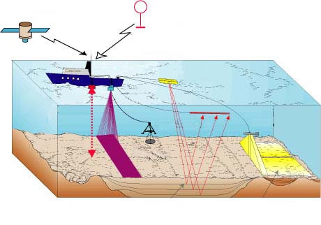
The making of a Scientific Theory - Advances in sonic depth recording during World War II and the subsequent development of the nuclear resonance type magnometer (proton-precession magnometer) led to detailed mapping of the ocean floor. |
 |
|
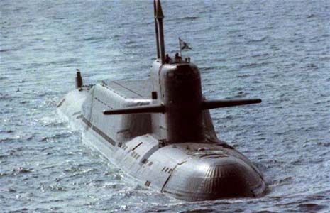
During the late 1950's and 1960's mainly due to the "Cold War"; both superpowers, the US and the Soviet Union started to study and map the ocean floor, they needed this information to plot routes for their nuclear submarines. |
 |
|
When all these investigations about the ocean sea floor were given scientists a new light in the composition of the rocks and their distribution. Wegener's ideas started now to make sense for most geologists. The saddest part is that at this time Wegener was already dead so he could not see his vindication. Samples from the ocean floor were for the first time collected and analyzed. |
 |
| In the 1950's paleomagnetism emerged as a new tool. When magma solidifies the iron bearing minerals become magnetized and take the polarity of the Earth at that time. The migration of the magnetic poles of the Earth through geologic time is called apparent polar wandering. Scientific evidence indicates that the magnetic poles have slowly and erratically wandered across the surface of the Earth. The symmetrical pattern of magnetic bands provided powerful support the for Wegener's hypothesis. | |
|
|
|
| There is clear paleomagnetic evidence that the continents of South America and Africa were joined together because both of their margins have the same paleomagnetic signature. Also by analyzing the paleomagnetic signature on some rocks in other continents we can clearly see that those continents were aligned in different positions to their actual locations. |
 |
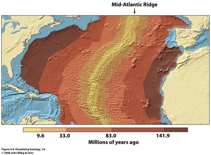
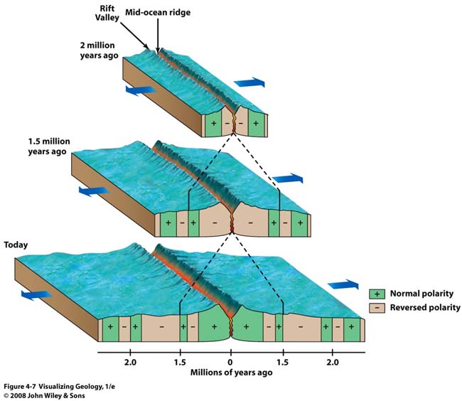
| By analyzing the rocks from the seafloor scientists also discovered that the age of the rocks increases as one moves away from a mid ocean ridge. This process it is now known as "sea floor spreading." Seafloor spreading is the processes through which the seafloor splits and moves apart along a mid-ocean ridge, and new oceanic crust forms along the ridge. | |
 |
|
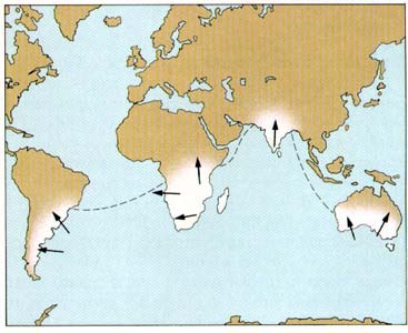
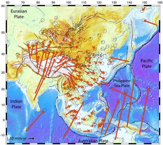
| Recently we have access to even a more profound evidence with the use of GPS. GPS also confirms estimated movement of plate velocities that vary from 1 to 10 cm a year. The picture on the right is showing directions and rates of plate movements captured by satellites. |
 |
 |
 |
Brooklyn College - Geology Department