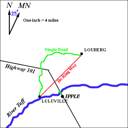

| "Hey, Lulu! I've been thinking! Look at this map! How come there are two roads from Louberg to Luluville? Why would anyone bother to build a curvy, indirect route like Dingle Road when the Bo Ring Way route is straight and so much shorter?!" | |
 |  | "Look at my map and you'll see!" |
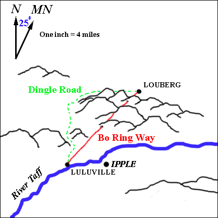
| "Wow! Cool map! Dingle Road must have been easier to build! It must be old! Old but scenic! It goes around all the hills! Bo Ring Way goes up, over and through the mountains! A miracle of modern, fast highway building! But a little dull! I really like those 3-D effects on your map, Lulu!" |
| "The map has its good points! But it doesn't tell you how high or steep the mountains are! And you can't see what's going on on the sides of the mountains facing away from us!" | |
| "True, true! But whad'ya gonna do?!" |
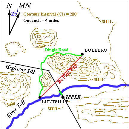 | "Get a map with topographic contours! A contour map!" | |
| "You mean those brown lines? How'm I gonna understand all that spaghetti?!" | |
 | "Take it step by step, Lou, step by step! Take a look at this picture!" | |
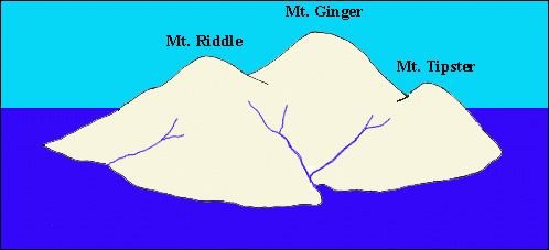
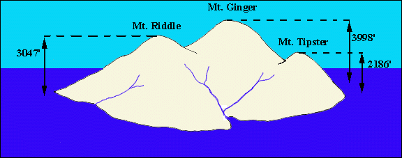 | "The heights above sea level (that is, the elevations) of the three peaks are 3047 feet for Mt. Riddle, 3998 feet for Mt. Ginger, and 2186 feet for Mt. Tipster!" | |
| "An island paradise! Three peaks, rivers flowing down to the sea! Very exotic!" | |
| Press the button to continue the exciting Contours Rollover!! |  |
| "That guy with the paintbrush sure had a lot of energy! What do you call those lines?" | | 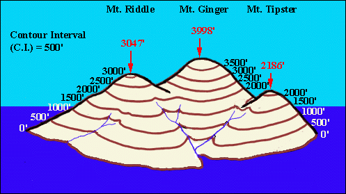 |
| "Those lines are called contour lines! They're lines of equal elevation above sea level! All the points on the lowest line are zero feet above sea level! All the points on the next higher contour line are 500 feet above sea level! And so on!" | |
| "That sounds cool!" |
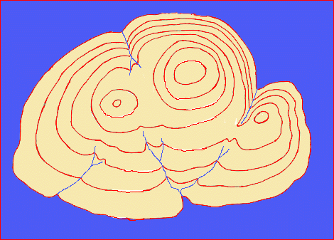 | "Hold on, Lou! That's not all! Then the guy flew over the island and looked straight down from way up high, and this is what he saw!" | |
| "All the painted shorelines - and the rivers! Like a map!" |
| "Right on, Louis! A CONTOUR MAP! Now we're in a position to 'see' the shape of the island and the elevation of any place on its surface! Go back to the 'Contours Maps Menu' and click on 'Labeling Contours'!!" |
© 2002
David J. Leveson