EXAM REVIEW - CONTOUR MAPS
EXAM REVIEW - CONTOUR MAPS
|
1. How can direction be determined without a compass or any other artificial device?
2. Explain the difference between 'height' and 'elevation'. 3. Why is determining sea level not a simple procedure? 4. What are the advantages of choosing a large contour interval as opposed to a small contour interval? 5. Explain why, on many contour maps, there are some contours whose elevations cannot be determined unambiguously. 6. On a contour map, what does it mean if two or more contours merge?
| |||
|
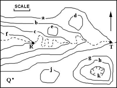
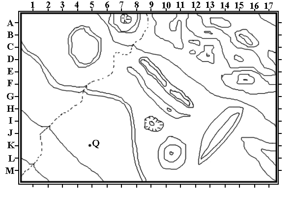
7. Refer to Figures 3 and 4. Assume the length of the scale bar is 25 miles, the contour interval is 50 feet, and the elevation of point Q is 728 feet.
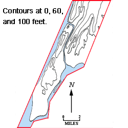
8. Refer to Figure 5 below.
Identify locations by use of the grid intersections. For example, point Q is closest to grid intersection K-5. For each of the following descriptions, choose the location of the best example.
|
©2003
David J. Leveson