 |
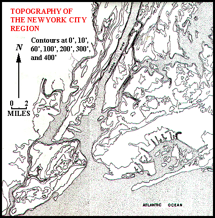
A first glance at the topographic map of the New York City region shows the landforms are very diverse and complex. To describe such a complicated region seems a daunting task. The task may be made more manageable by breaking the region down into areas within which particular types of landforms dominate. The picture may be further simplified by increasing and varying the contour interval so as to eliminate unnecessary detail. |
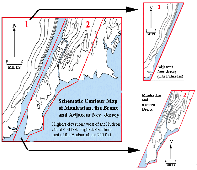
| As a first step it is useful to consider Manhattan, the Bronx, and adjacent New Jersey separately from the western end of Long Island (Brooklyn and Queens). |  |
| It then helps to treat Manhattan and the western Bronx separately from adjacent New Jersey. | |
 | |
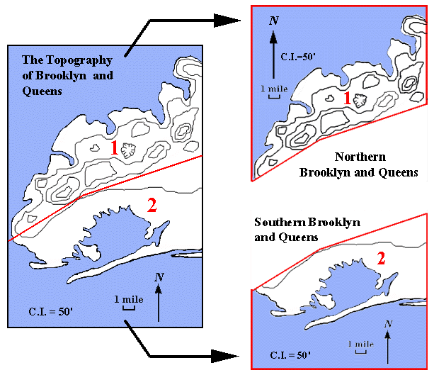
| Similarly, Brooklyn and Queens can be separated into northern and southern units. | |
 | |
| Now the landforms of each of these four individual areas can be separately examined and described. Then, if desired, the four descriptions can be used to create a description of the entire region. | |