THE GEOLOGY OF THE NEW YORK CITY METROPOLITAN AREA
1. LOCAL GEOGRAPHY.
 | First, learn the geography of NYC!! Press the button! |  |
| Next, learn the geography of the NYC metropolitan area!! Press the button!! | |
2. LOCAL AND REGIONAL TOPOGRAPHY.
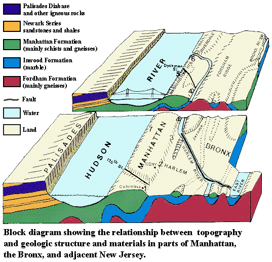
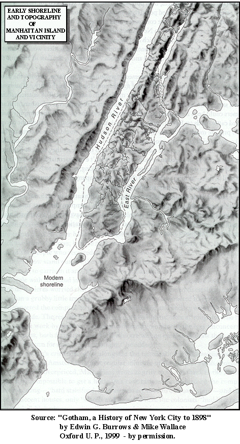
Topography is the description of the configuration of the surface of the land, including the sizes and shapes and elevations above sea level of such features as hills, valleys, cliffs and plains. In the figure to the right, you can see a drawing that illustrates the topography of the island of Manhattan and surrounding regions when the area was first encountered by European settlers. Note the ways in which the modern shoreline of Manhattan (indicated by the dashed line) differs from the 17th century shoreline. |
 |
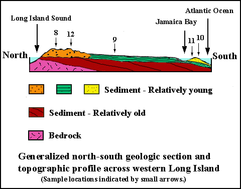
The satellite image below shows the topography of much of the northeastern United States and illustrates the regional topographic setting for the New York metropolitan region. See if you can locate the features that you identified on Figures 1A and 1B.

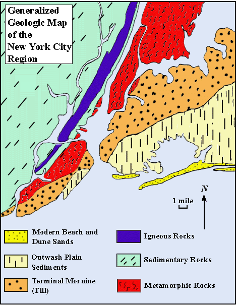
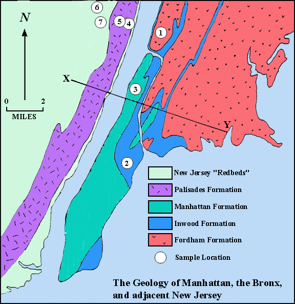
3. LOCAL AND REGIONAL GEOLOGY.