 |
|
STONEHENGE- U.K.
 |
 |
| Location: | Geographic coordinates: | Area: | Area - comparative: |
| Western Europe, islands including the northern one-sixth of the island of Ireland between the North Atlantic Ocean and the North Sea, northwest of France . | 54 00 N, 2 00 W | total: 244,820 sq km | slightly smaller than Oregon |
| Population: | Languages: | Capital: | Currency: |
| 59,778,002 (July 2002 est.) | English, Welsh (about 26% of the population of Wales), Scottish form of Gaelic (about 60,000 in Scotland) | London | British pound (GBP) |
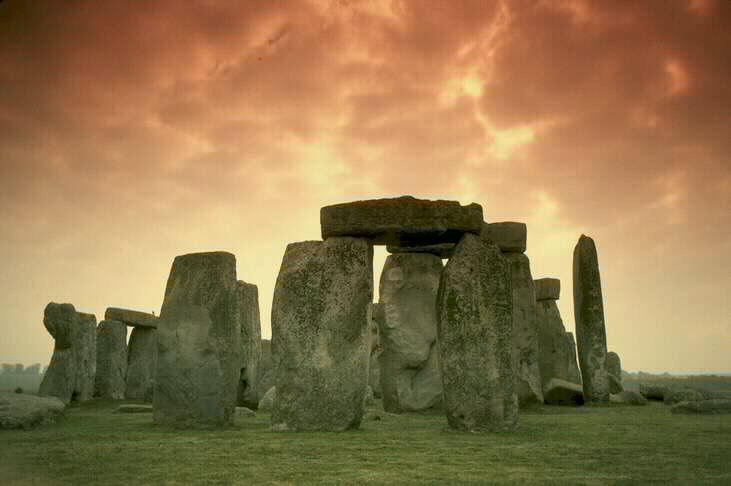
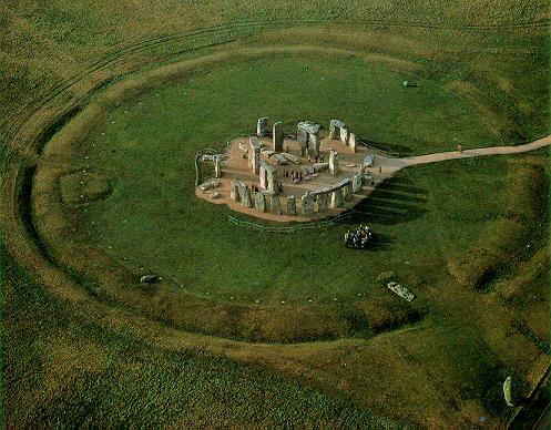
| Types of rocks used on the monument: | Dolerite (Igneous rock) |
STONEHENGE - Already in the 18th century the British antiquarian William Stukeley had noticed that the horseshoe of great trilithons and the horseshoe of 19 bluestones at Stonehenge opened up in the direction of the midsummer sunrise. It was quickly surmised that the monument must have been deliberately oriented and planned so that on midsummer's morning the sun rose directly over the Heel Stone and the first rays shone into the centre of the monument between the open arms of the horseshoe arrangement.
This discovery has had tremendous impact on how Stonehenge has been interpreted. For Stukeley in the 18th century and Sir Norman Lockyer in the first years of the 20th century, this alignment implied a ritualistic connection with sun worship and it was generally concluded that Stonehenge was constructed as a temple to the sun. More recently, though, the astronomer Gerald Hawkins has argued that Stonehenge is not merely aligned with solar and lunar astronomical events, but can be used to predict other events such as eclipses. In other words, Stonehenge was more than a temple, it was an astronomical calculator.

© Prof. Nehru E. Cherukupalli / Brooklyn College Geology Department