 |
|
EL TAJIN - MEXICO
 |
 |
| Location: | Geographic coordinates: | Area: | Area - comparative: |
| Middle America, bordering the Caribbean Sea and the Gulf of Mexico, between Belize and the US and bordering the North Pacific Ocean, between Guatemala and the US | 23 00 N, 102 00 W | total: 1,972,550 sq km | slightly less than three times the size of Texas |
| Population: | Languages: | Capital: | Currency: |
| 103,400,165 (July 2002 est.) | Spanish, various Mayan, Nahuatl, and other regional indigenous languages | Mexico City | Mexican Peso (MXN) |
| Types of rocks used on the monument: | Shale, Sandstone and Limestone (all sedimentary rocks). As plaster caliche was used. Caliche is a form of calcium carbonate found in thick stratigraphic accretions and thin depositional lenses. |
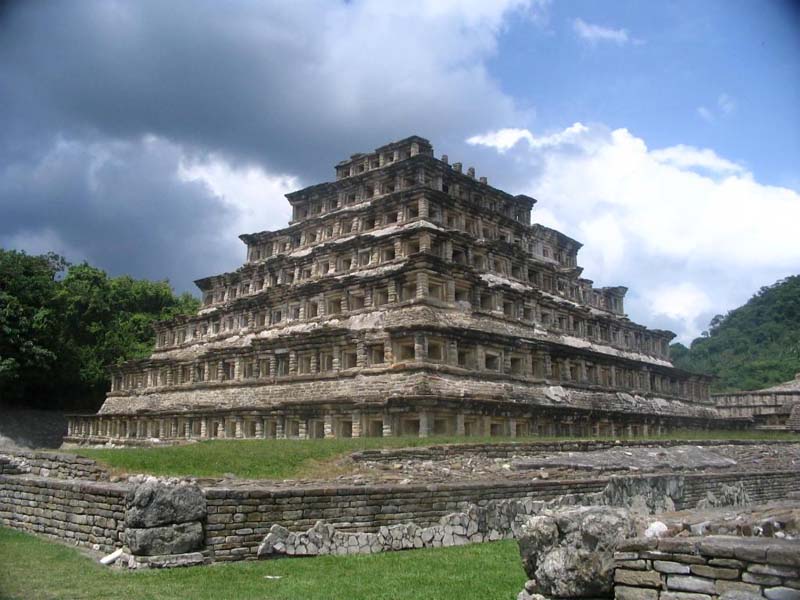
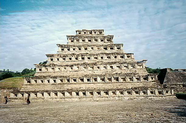
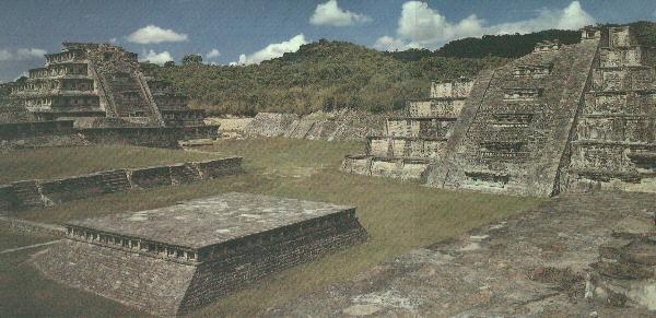
EL TAJIN - El Tajin has some very unusual structures. Over 150 have buildings and structures have been identified on the site, although so far, only around 20 have been excavated and restored. Most archaeological sites you'll visit in Mexico were buried under mounds of earth and grass - reclaimed by the land after several hundred years of abandonment. El Tajin is one of Mexico's most enigmatic archaeological sites. A comprehensive archaeological excavation project keeps revealing even more unusual structures and buildings here. As El Tajin unravels with intricate complexity, it keeps throwing up more and more mysteries. Like other archaeological sites in Mexico, the structures seem to resemble calendars and time - an example being the pyramid of Niches, with its 365 recesses. Games Courts feature heavily here - 17 have been discovered already. As with some other archaeological sites, it is clear that human sacrifices were made at El Tajin too; it is believed that these were connected with the games played here.
© Guillermo Rocha, P. G. / Brooklyn College Geology Department