 |  |
| |
1. Print out this page.
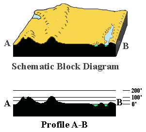
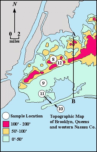
2. A topographic profile between point A on the north shore of Queens and point B on the south shore of Rockaway has been constructed. (See above.) What is the vertical exaggeration of the profile? (Hint: Convert the map scale into feet.) _______________
3. A schematic three-dimensional (block) diagram has been drawn that has profile A-B as its western face. (See above.) Examine this block diagram, the profile A-B, and the map. Then, on a separate piece of paper, write a paragraph describing the topography (natural landscape) of Brooklyn and Queens.